Google Moon is a service similar to Google Earth that shows satellite images of
the Moon. It was launched by Google on July 20, 2009, the 40th anniversary of the Apollo 11 lunar landing. The landing site of each of the Apollo missions is shown on the satellite image, providing more information on each mission as the user zooms in.
Early Version
The first version of Google Moon only included low-resolution satellite imagery of the
entire Moon, and when zoomed in too close, a Swiss cheese pattern would appear. The Swiss cheese pattern was used for the closest zoom levels before high-resolution images became available.
Current Version
The current version of Google Moon has three modes.
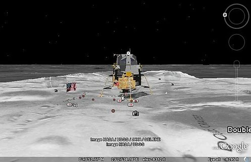
Apollo mode
Apollo provides information about each of the Apollo missions, including placemarks, maps, images, video, and Street View-style panoramas, all provided by NASA.
Visible mode
This mode provides the satellite imagery for the Moon, provided by the Clementine mission.[2]
Elevation
This shows a false color rendering of the Moon's elevation.
Charts
A Charts layer is also available. This shows Apollo-era geologic and topographic charts for certain areas of the Moon's surface.
Moon View in Google Earth
Google Earth 5 includes a separate globe of the moon, starting on July 20, 2009 to commemorate the 40th anniversary of the Apollo 11 Moon landing. The maps are of a much higher resolution than those on the browser version of Google Moon and it also includes 3D renderings of the Moon terrain.
External links
| This page uses Creative Commons Licensed content from Wikipedia (view authors). |